

This is it folks. I’m staring down the last few days before I make the official switch from 30 years to 31 years of age. It’s coming close to time to turn the page over to the next chapter, but this one still needed a gripping finale. My hiking partner and I started this great tradition a few years back on a hiking trip of the Grand Canyon. Now every year at birthday time we choose a hike to celebrate this wonderful life we live. This year I decided to celebrate close to home and take the trek to the summit of New York State’s highest peak, Mount Marcy.

The panorama from the summit
Marcy is not the hardest peak to summit. Marcy is not the longest hike in the ‘Dacks. Marcy is, however, the highest point which made it the prime choice for a particularly rewarding birthday hike. At 5,343 feet, the bald peak of Marcy holds a commanding view over the lower peaks that entices many hikers to take the relatively tame hike to the summit. I have read that the popularity of Marcy has brought over 40,000 visitors each year. Most of the visitors take the hike in the summer months crowding the summit. On this chilly November day we shared the summit with only two small groups.
Our trio started out early from the parking lot at the Adirondack Loj and went up the Van Hoevenberg trail for the most direct approach. We anticipated that the hike would consume all of the daylight we had available. We hit the trail in the dark early morning under a thin crescent moon. There was a thick frost covering everything is sight. We bundled up for the cold early morning air, strapped on our headlamps, and headed into the dark woods. The first two miles of the hike is just a gentle walk through a mixed hardwood forest with barely a rock to trip over. The light from our headlamps bounced off the ice crystals that clung to every surface from the tops of the trees to the ground beneath our feet. We walked slowly through this glittery world for only about one mile before the sun had come up enough to make our headlamps unnecessary. Filtered views of the surrounding peaks towering above could be seen through the leafless branches.
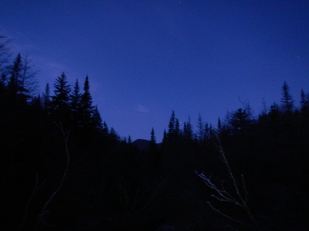
The early morning sky.
Just over two miles into the hike we came up on Marcy Dam. Marcy Dam has always been a popular camping spot for those looking to make a base camp for a weekend of “peak bagging” some of the 46. Before Hurricane Irene, Marcy Dam held Marcy Pond. Today Marcy Pond is just a memory for many after it was emptied in the wake of the dam’s collapse. My hiking partners and I will only know Marcy Pond as the land Mother Nature re-claimed. Today the crossing over Marcy Brook is located about 200′ below the dam by way of a newly constructed bridge.
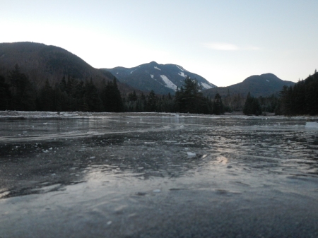
The view from Marcy Dam
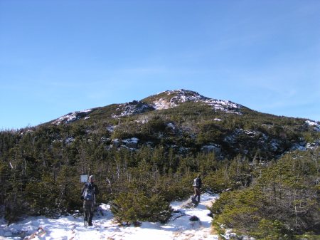
Another two miles of gentle incline past Marcy Dam brought us higher and deeper into thick pine forests. The absence of sunlight penetrating the pines made for an increasingly icy trail floor. We ascended alongside a clear Adirondack stream, increasingly larger boulders, and increasingly slippery trail conditions. The first lookout view showing the height of our ascent was a picture perfect frame of last week’s summit of Big Slide Mountain. We took a moment to warm ourselves in the sun and stare out over the mountains. As with any mountain hike, the views are forever changing in nature’s temporary art. I could go on about the hundreds of beautiful things we witnessed along the way, or I can direct you to the slideshow at the bottom of this blog and move on a few miles.
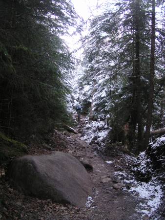
The increasing incline past Marcy Dam
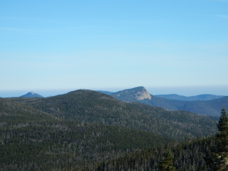
Big Slide Mountain (center) as seen from the first open outlook.
Fast forward that few miles and we find ourselves standing, perched in a clearing, looking up beyond the treeline at the bald alpine summit of Marcy. From this clearing on to the summit, traction devices were absolutely necessary. The ascent made it seem as though we were climbing a frozen waterfall. Not only does a good set of crampons keep you safe, but it will also make your journey a much more enjoyable one. This steep half mile of sheer ice opens up again to a gentle stroll along a short wooden path and another magnificent view of the summit. The trees at this altitude were now barely taller than my 5’8″ frame. The sunshine was no longer blocked by the short trees’ taller siblings. I paused to knock off a layer, take in some water, and stare up toward the summit. It was so close I felt as if I could almost reach out and touch it.
The last flat area before the final ascent.
Past this wooden walkway, is what I consider the steepest part of the hike. Signage will prompt hikers to use caution and consider the fragile and highly endangered plant life off of the marked trail. The trail markers turn from blue metal markers in the trees to yellow lines painted on the open rock face. Much of the protected plant life is surrounded by small rocks to clearly mark where hikers should avoid. Being here in this exposed terrain high above the rest of the world can bring on uneasy feelings. Looking down over the steep rock and sheer drops is not the best plan for anyone uncomfortable with heights. Keeping our eyes on the prize (and minds on those great egg salad sandwiches in my pack) we continued non stop to the top. Reaching the summit of any mountain brings an immense feeling of pride for what you have accomplished. We each made our way to the top of the highest boulder and sat to enjoy our lunches and stare out over the perfect, unobscured 360 degree view. We couldn’t have asked for a more perfect day to reach the summit.
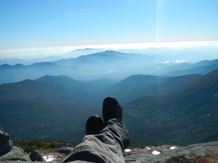
Sprawled out relaxing at the summit.
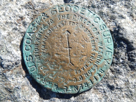
The Summit marker.
With full bellies and cold digits we packed up and prepared for the descent. Leaving the sky behind us, we bounced, slid, scuffled, rolled, and bumped our way back down the Van Hoevenberg Trail. Well, two of us managed to roll, bump and bounce while the more cautious of the three used her head and managed the entire trip on her feet. On a good note, I discovered that I still bounce well in my old age!
The descent is always quick. The cool down time past Marcy Dam along that mellow trail we visited in the early morning was very welcome. The Van Hoevenberg trail was certainly not as physically demanding as others, but we had definitely worked off everything we had eaten and were feeling the effects of waking up so early. There is only one way to nourish a bunch of hikers after a long day. A burger and a brew of course! Off to our favorite after hike stomping grounds for the perfect close to a perfect birthday hike.

